Earth and Us
Earth and Us에 대한 설명글입니다.
[Intelligence] Geometric Modeling Accuracy Assessment of KOMPSAT-5
- #KOMPSAT
- #SAR
- #Satellite imagery
- #Accuracy
- #GCP
This time, I would like to share some interesting research results regarding the geometric modeling accuracy of the KOMPSAT-5 satellite.
In this study, two sets of KOMPSAT-5 L1A standard mode images were used to compare the accuracy when Ground Control Points (GCPs) were utilized versus when they were not.
The first set consists of four images taken in the beautiful city of Ottawa, Canada, while the second set comprises nine images captured in Kelowna, British Columbia.
The research was conducted using PCI OrthoEngine software.
Ottawa, Canada
The Ottawa area has an elevation ranging from 40m to 330m.
The images were captured between February and May 2019, with a resolution of 3m GSD, making them very clear.
Below is a figure showing the nine KOMPSAT-5 images.
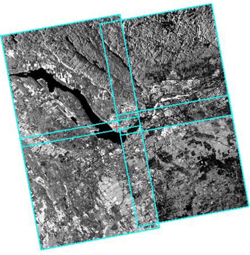
Figure 1. Four KOMPSAT-5 images overlaid
In this study, 21 GCPs were collected through 20cm aerial photographs, and 24 tie points were also automatically collected.
The table below shows the residuals and errors of the GCPs. Interestingly, the RMS error when GCPs were not used was almost similar to the RMS residual when GCPs were used.
In both cases, the error was within 2 pixels. This indicates that the collection of GCPs does not significantly impact the geometric accuracy of KOMPSAT-5 data.
Especially in mountainous areas, where it is quite challenging to collect GCPs, this news is very encouraging! Users can easily generate orthophotos with an RMS error of within 2 pixels anywhere in the world by utilizing provided RPCs and digital elevation models like SRTM DEM.
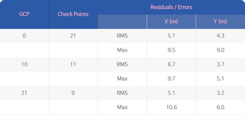
Table 1. GCP residuals/errors
Kelowna, Canada
Next is the Kelowna area, which has an elevation ranging from 350m to 2100m and is mountainous, making it impossible to collect GCPs. Instead, 211 tie points were automatically collected.
The orthophoto was generated using 1 arc-second SRTM DEM. Below is a figure showing the mosaic created from the nine images.
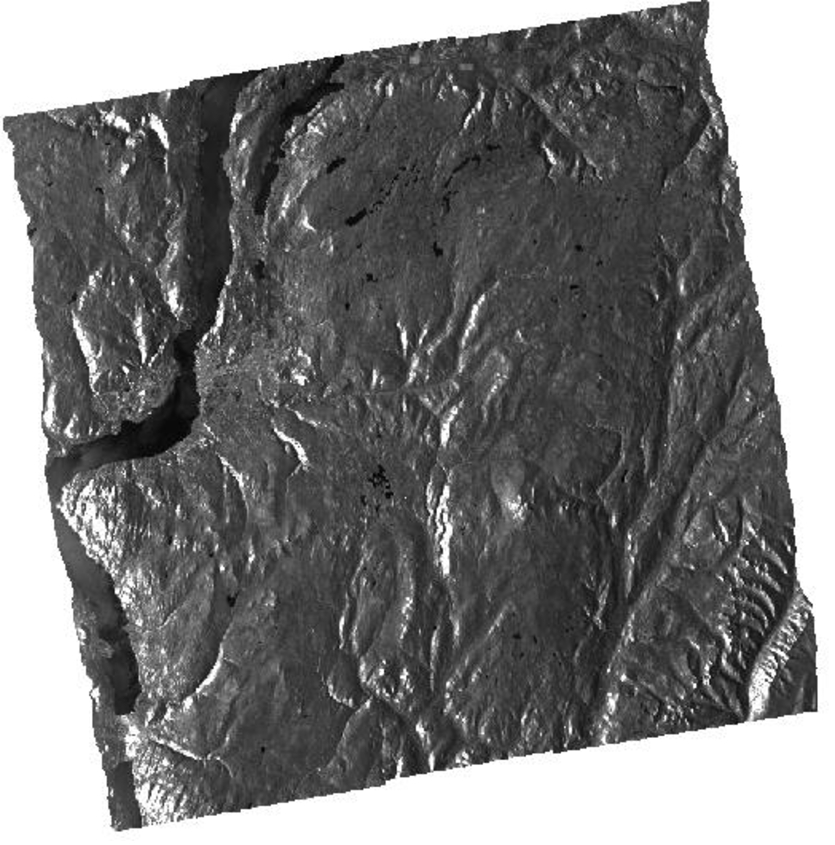
Figure 2. Mosaic of nine KOMPSAT-5 images
To verify the accuracy of the mosaic, vector layers of roads and water bodies were used.
In the figure below, the road vector is shown in red, and the water body vector is shown in blue.
You can see how well these vectors overlap with the mosaic!
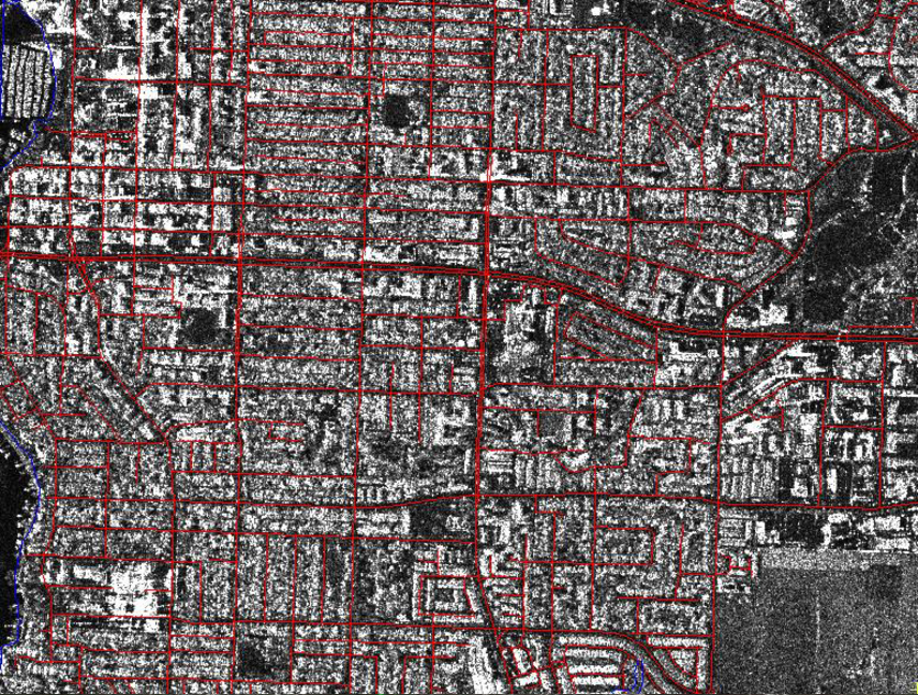
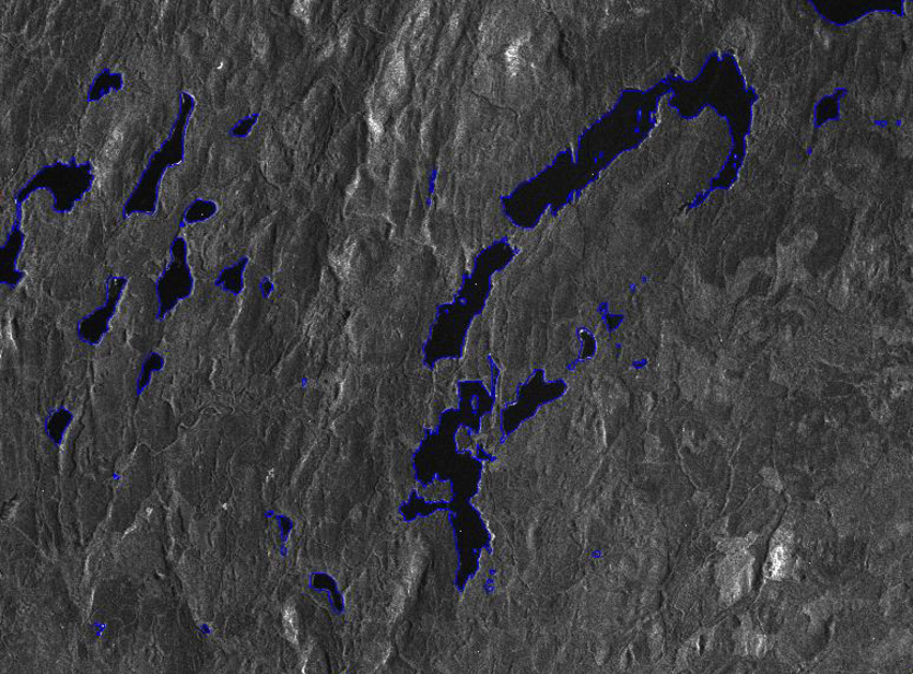
Figure 3. KOMPSAT-5 ortho image overlaid with water body vectors
❓Why is it Difficult to Collect GCPs in Mountainous Areas?
Collecting GCPs automatically in mountainous areas is a challenging task for several reasons.
First, mountainous regions have significant elevation changes and steep slopes, which complicate the identification of specific points in satellite images.
In particular, shadows and reflections can distort the features of the terrain.
Additionally, these areas often have dense vegetation, such as trees and shrubs, which reduces the visibility of the ground and hinders the search for potential GCP locations.
While high-resolution satellite images can be used, the resolution may not be sufficient in certain mountainous areas, making it difficult to accurately discern the details of the terrain and identify GCPs.
Weather conditions also pose a problem. Mountainous regions experience significant weather variability, and clouds or fog can degrade the quality of satellite images, reducing the accuracy of GCP collection.
Moreover, mountainous areas are often difficult to access, making field surveys or additional validation work challenging, which can complicate the verification of the accuracy of automatically collected GCPs.
Finally, the complex terrain and diverse geographical features of mountainous regions can complicate the data processing, presenting additional challenges for automated systems to accurately identify GCPs.
Due to these various factors, automatically collecting GCPs in mountainous areas involves technical, environmental, and physical challenges.
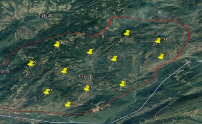
Examples of GCP Collection in Mountain Areas / Images ©jouav
This study evaluated the geometric modeling accuracy using two sets of KOMPSAT-5 L1A standard mode data.
It is truly fascinating that data can be corrected without GCPs!
The results showed that it is possible to generate corrected images with an RMS accuracy within 2 pixels.
There is great anticipation for various future studies utilizing KOMPSAT-5 data!
💾 Clicking the icon will take you to the data download page.
Source: ©PCI Geomatics / ©KARI / ©SIIS


