Earth and Us
Earth and Us에 대한 설명글입니다.
[Intelligence] Bahamas Flooding Before and After Change Detection
- #KOMPSAT
- #SAR
- #Disaster Management
- #Change Detection
- #Bahamas
- #Flooding
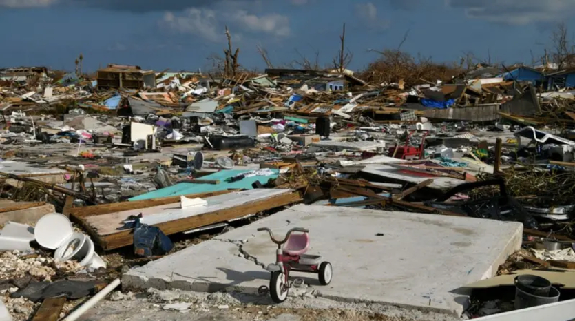
The Great Abaco Region Affected by Hurricane Dorian / Photo. BBC News Korea
On September 1, 2019, Hurricane Dorian struck the Bahamas in the Caribbean.
Dorian was a Category 5 hurricane, one of the most powerful and destructive storms recorded in the region, and it is considered the strongest tropical cyclone in Bahamian history as well as the most powerful hurricane to make landfall in the Atlantic basin.
This hurricane is regarded as the worst natural disaster in the Bahamas.
Category 5 is the highest classification in the Saffir-Simpson Hurricane Wind Scale, which categorizes hurricanes based on their maximum sustained wind speeds.
A Category 5 hurricane has maximum wind speeds of 157 mph (252 km/h) or higher.
If you look at the image below, you can see the representations of categories 1 to 5. Do you have a sense of how intense a Category 5 rating is?
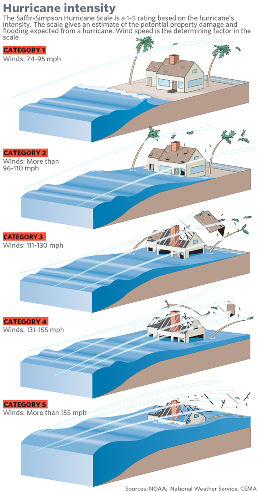
Category 5 hurricanes are extremely destructive and can cause severe damage due to their strong winds.
Areas affected by such storms can experience significant destruction to buildings, trees, and infrastructure, posing a serious threat to life and property. Hurricanes like Dorian, classified as Category 5, can result in particularly devastating impacts.
Dorian was one of the strongest hurricanes recorded in the Atlantic, with sustained wind speeds reaching 185 mph (295 km/h).
It surpassed Hurricane Irma from 2017, becoming the most powerful hurricane recorded outside the Caribbean in the Atlantic.
Dorian was the fourth named storm of the 2019 Atlantic hurricane season, the second hurricane, the first major hurricane, and the first Category 5 hurricane of that season.
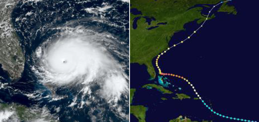
On the left, you can see a map of the Abaco Islands near Dorian's maximum intensity, while the right side shows the storm's path and intensity.
SAR satellites can analyze changes on the ground, penetrating clouds, fog, and darkness.
This capability allowed the KOMPSAT satellite to detect damage and capture satellite imagery when Dorian reached the Bahamas.
Using the Enhanced Standard (ES) mode of KOMPSAT-5, it captured wide areas with a 2.5m resolution over a 30 km swath.
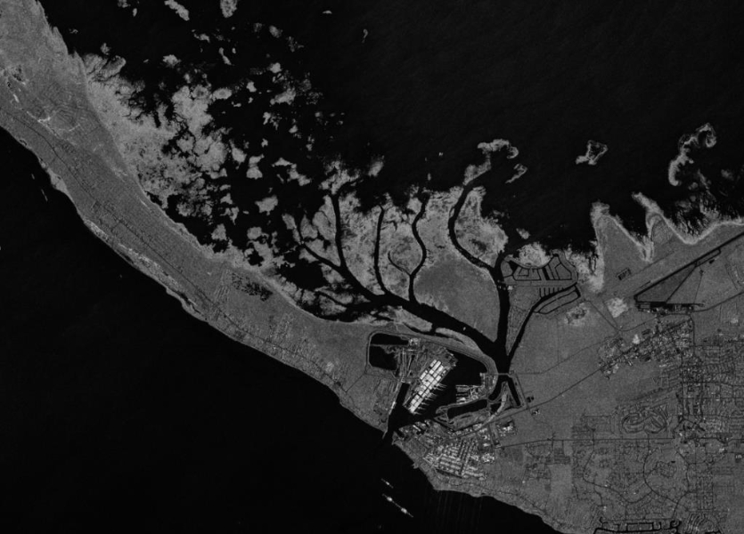
Before the flood, taken on August 31, 2019
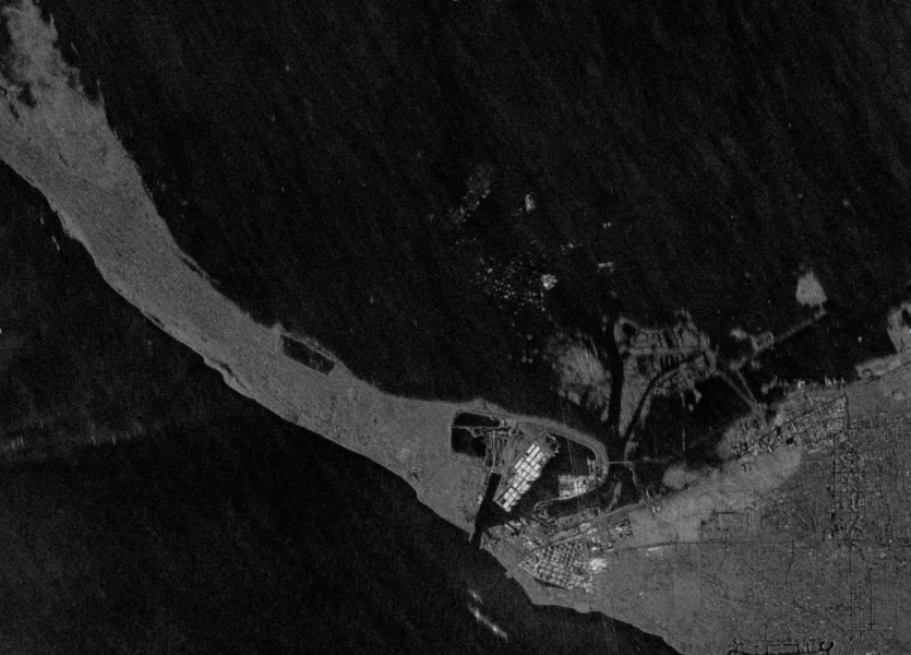
After the flood, taken on September 2, 2019
Comparing the before-and-after images reveals that much of Grand Bahama Island was submerged due to the heavy rain and storm surge caused by Hurricane Dorian.
The post-flood imagery shows extensive flooding, including the major airport on Grand Bahama Island.
It's truly fascinating how satellite imagery can provide a clear view of the impacts of natural disasters!
In the face of unstoppable nature, may satellite imagery play a significant role in disaster prevention.
💾 Clicking the icon will take you to the data download page.
Source: ©URSA Space, ©KARI, ©SIIS


