Earth and Us
Earth and Us에 대한 설명글입니다.
[Intelligence] DSM Generation of the World's Largest Mining Using KOMPSAT-3A
- #DSM
- #KOMPSAT
- #Satellite imagery
- #Bingham Canyon Mine
- #Study
This study introduces a method for generating a DSM(Digital Surface Model) using stereo data from the KOMPSAT-3A satellite.
The research focuses on the Bingham Canyon Mine, located in Utah, USA. This copper mine is known as the largest man-made excavation in the world and is also famous for being the most productive copper mine in history.
❓Why was the Bingham Mine chosen for generating the DSM?
A DSM includes data that accounts for the heights of buildings and trees, among other features.

Large mines like the Bingham Canyon Mine are suitable for research because they feature a mix of artificial excavation and natural terrain, making steep slopes and distinct elevation changes easily visible.
In particular, the mining method used at Bingham Canyon is an open-pit technique, which involves stepwise excavation from the surface. This allows for large-scale mining and provides a structure that can continuously expand the depth and size of the mine.
Currently, the mine is reported to be about 1,800m deep, 5km long, and approximately 4km wide. Its massive scale has even earned it designation as a state historical landmark.
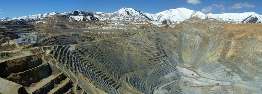
Source: © inscc.utah.edu / Sebastian Hoch photo
This research was conducted by Dr. Philip Cheng, a senior scientist at PCI Geomatics, utilizing satellite image data from the KOMPSAT-3A. The data was provided to our SIIS.
We provided a Level 1O single-pass stereo image acquired on September 25, 2019, with a capture angle of +/- 24 degrees from the KOMPSAT-3A.
Level 1O refers to a processing level known as ortho-ready, where geometric distortions have been corrected and the product is projected in the UTM(Universal Transverse Mercator) coordinate system.
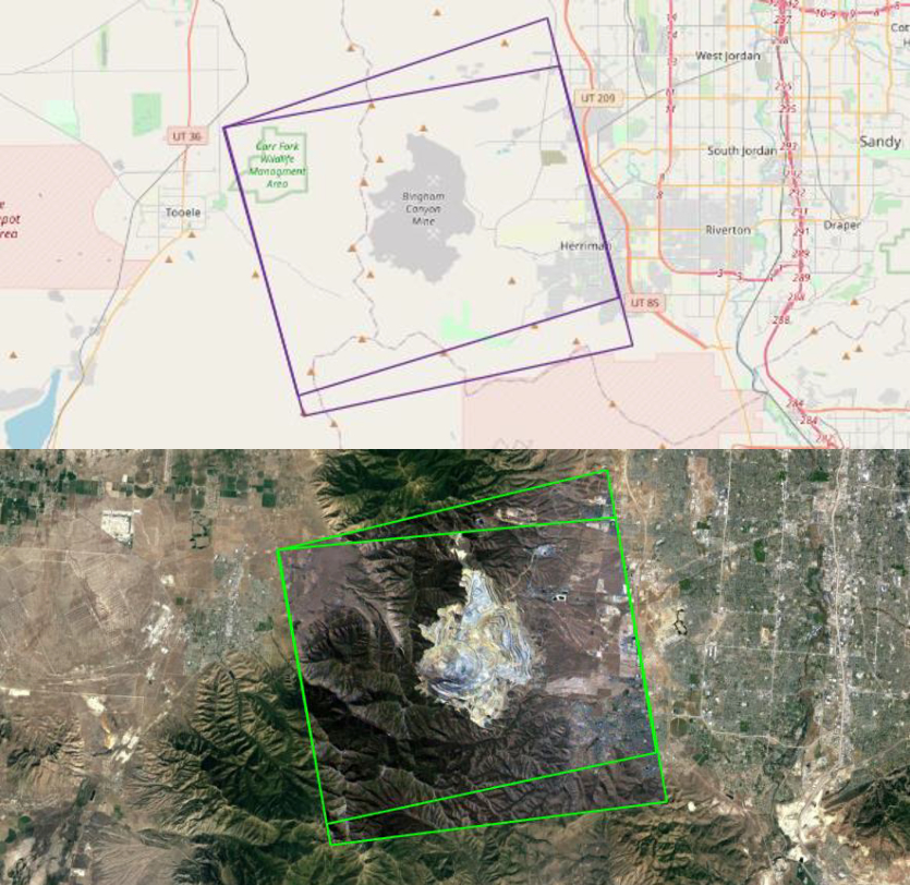
Outline of KOMPSAT-3A stereo images acquired in 2019
In this study, all data processing was performed using PCI OrthoEngine software, which utilized the RPC(Rational Polynomial Coefficients) geometric model option for processing.
Since GCPs(Ground Control Points) were not available for the research, only TPs(Tie Points) were collected through OrthoEngine's automated procedures.
This approach enhanced the accuracy of the data and allowed for the generation of a more precise DSM(Digital Surface Model).
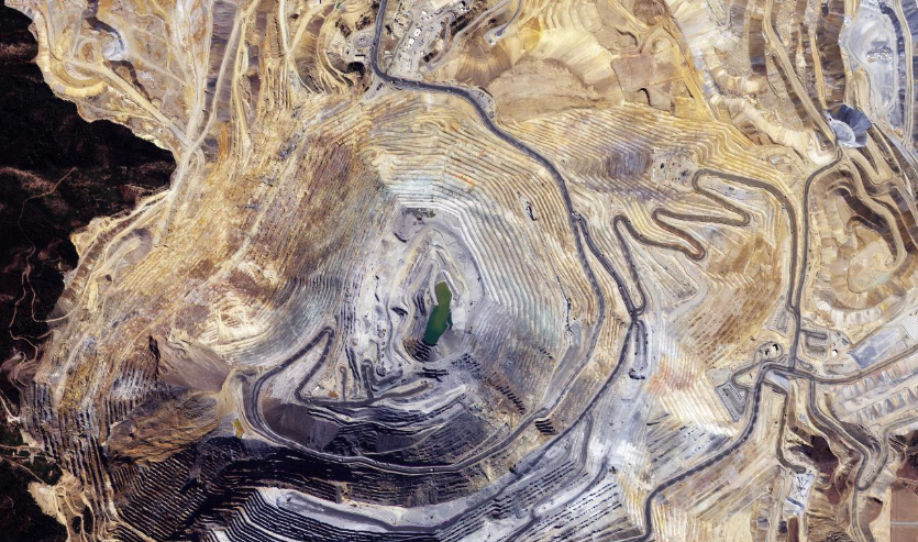
KOMPSAT-3A Pan-Sharpened orthorectified imagery
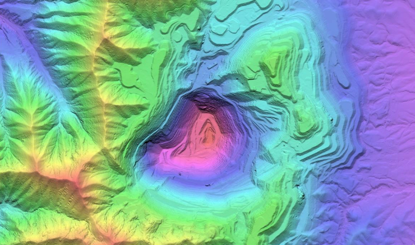
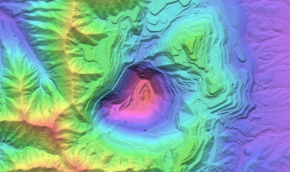
DSM extracted using KOMPSAT-3A imagery
The research results indicate that the stereo images from the KOMPSAT-3A satellite are suitable for extracting DSMs(Digital Surface Models).
The DSM of the Bingham Mine, extracted at a 1m resolution, effectively represents the varying depths and heights from the high mountain ranges of the natural terrain to the very deep areas at the center of the mine, using a range of colors.
Notably, when using Level 1O data, better results were observed in extracting the DSM through the RPC method.
The stereo images from the KOMPSAT-3A satellite are not only useful for DSM generation but can also be applied in various fields such as mapping, disaster management, and urban monitoring.
When combined with GIS(Geographic Information Systems), this data can provide even richer information and is expected to play a significant role in various industrial sectors.
In this way, the KOMPSAT satellite imagery contributes to the advancement of modern geographic information technology, and it is anticipated that further research and applications will continue in the future.
I encourage you to explore this fascinating topic further!
💾 Clicking the icon will take you to the data download page.
Source: ©PCI Geomatics / ©KARI / ©SIIS


