Earth and Us
Earth and Us에 대한 설명글입니다.
[Intelligence] High Accuracy Mosaic Generation Using KOMPSAT-3A Data
- #KOMPSAT
- #Satellite imagery
- #Mosaic
- #Ortho mosaic image
- #Study
This study aims to explore the method of creating high-precision mosaics using images from the KOMPSAT-3A.
The research area selected is the beautiful city of Ottawa, Canada, and Dr. Philip Cheong from PCI Geomatics conducted the study using PCI OrthoEngine software, providing the results.
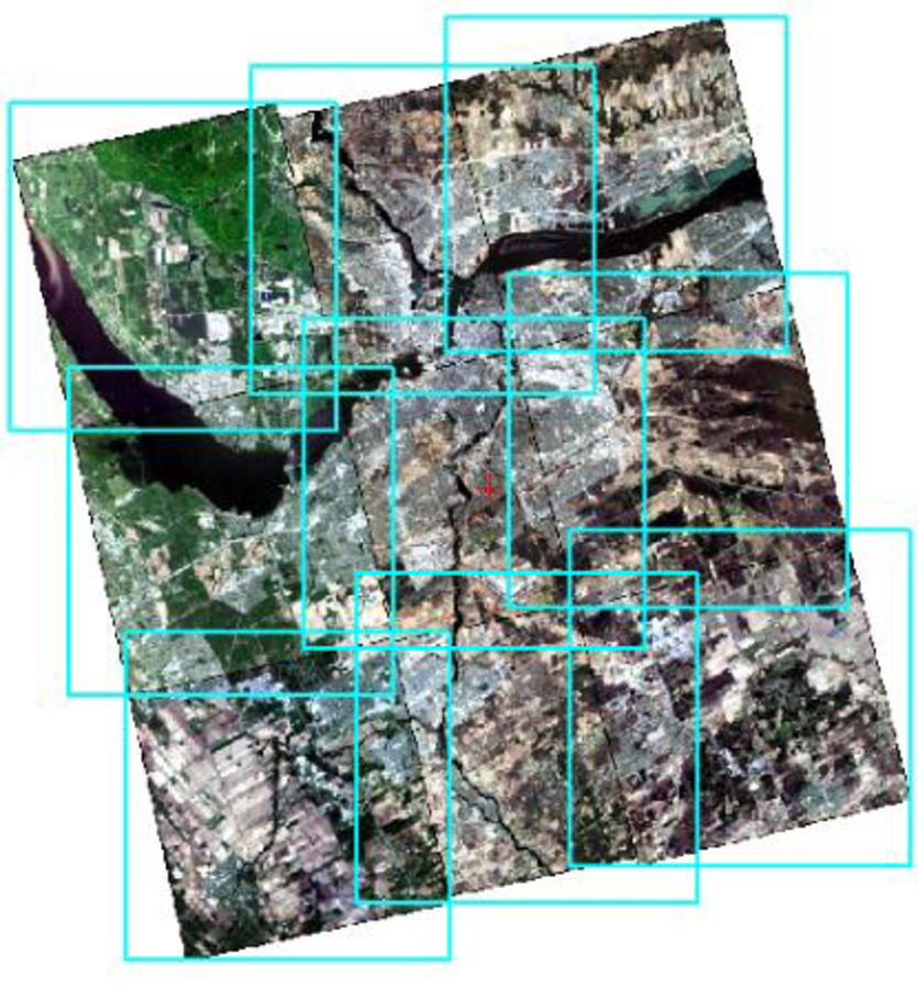
The research was based on nine L1O images from the KOMPSAT-3A, captured between April and June 2017, provided by SIIS.
Since the L1O image data comes with RPC (Rational Polynomial Coefficients) data, the RPC geometric modeling method can be utilized.
This data has overlapping areas, making it suitable for mosaic creation.

Figure1. Nine KOMPSAT-3A images before correction
❓What is a Mosaic?
Mosaic is a technology that combines multiple images into a single continuous image to provide a comprehensive view of a wide area.
In this process, overlapping parts of each image are precisely aligned, and color adjustments are made to create a natural and consistent result.
Mosaic is utilized in various fields, including satellite imagery and aerial imagery, and plays a crucial role in GIS (Geographic Information Systems).
This technology can be used to create maps, manage urban development, and monitor crops.
It is particularly active in disaster response, as it can quickly assess damage during natural disasters such as floods, wildfires, and earthquakes.
After a disaster occurs, mosaics can be used to analyze the extent of the damage and help prioritize recovery efforts.
This enables governments and relevant agencies to respond effectively.
🪧 Steps for Mosaic Generation
1. Pan-Sharpening: The first step is pan-sharpening. In this process, the original panchromatic data is combined with multispectral data to create a high-resolution multispectral image. Since the KOMPSAT-3A L1O data is already aligned, we can directly use the raw data for pan-sharpening. The figure below shows the original panchromatic data, multispectral data, and the result of the pan-sharpening process.

Figure2. Original Panchromatic, Multispectral, and Pan-sharpened data in a row
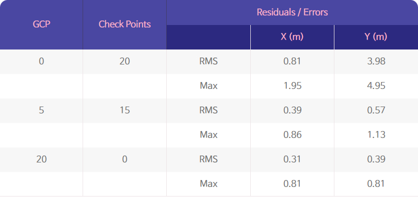
2. GCP/TP Collection: The second step involves collecting GCPs (Ground Control Points) and TPs (Tie Points). We collected 20 GCPs using 20cm aerial photographs, and 129 TPs were automatically collected. The table below displays the residuals and errors of the GCPs. As a result of collecting GCPs, we found that the RMS (Root Mean Square) error of the check points was close to about 1pixel.

Table1. GCP residuals/errors
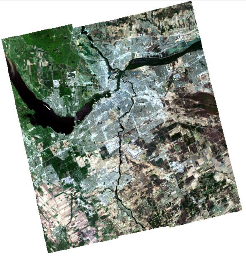
3. Ortho-mosaic Generation: The final step is generating the ortho-mosaic. We used PCI mosaicking software to create the mosaic through automatic cutline generation and color balancing. The figure below shows the final mosaic result.

Figure3. Ortho-mosaic image
Through this research, we explored how to generate a high-precision mosaic using KOMPSAT-3A images. It is impressive that using GCPs allows the RMS error of the geometric model to be maintained within about 1 pixel.
This study emphasizes the importance of generating precise geographic information using satellite data and demonstrates the potential for various applications in the future.
If you have developed an interest in satellite data, keep an eye on future research and applications!
💾 Clicking the icon will take you to the data download page.
Source: ©PCI Geomatics / ©KARI / ©SIIS


